This years’ super El Niño event has started a widespread discussion about its possible impact on UK weather in the coming months. This article explains what El Niño is and how it may affect the UK.
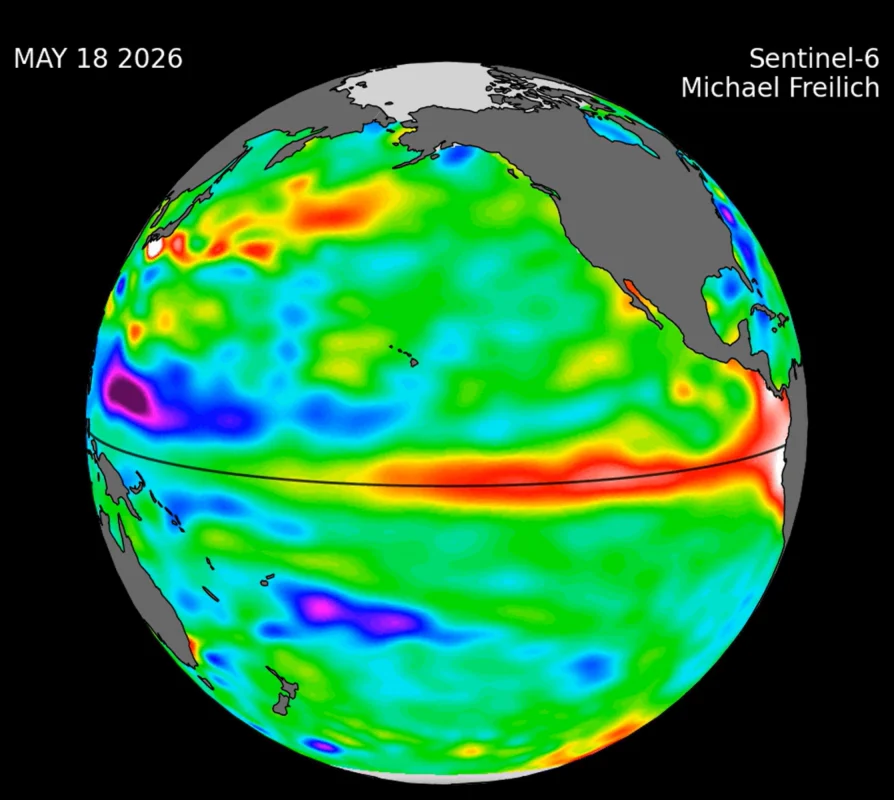
What Is El Niño?
El Niño–Southern Oscillation (ENSO) is a natural climate cycle driven by changes in Pacific Ocean winds and currents. It changes weather patterns, resulting in more extreme weather in the Southern Hemisphere. ENSO has three phases; Neutral, El Niño and La Niña.
El Niño is caused by easterly winds in the southern Pacific Ocean weakening or even reversing, this results in sea surface temperatures rising. It occurs every three to seven years and affects weather worldwide, particularly in the Southern Hemisphere, causing extreme weather events ranging from heavy rainfall and hurricanes to droughts and wildfires.
It is named El Niño as this event brings warmer water to the South American coastline, bringing lots of fish with it. Local fishermen named it El Niño de Navidad, as they noticed it was around Christmas time when El Niño occurs.
What Makes This El Niño Event Different?
For an ENSO event to be classified as El Niño, sea surface temperatures in the Pacific need to rise 0.5°C above the long-term average. Anything below 1°C is considered a weak event, between 1-1.5°C is considered moderate, 1.5-2°C is strong and above 2°C is considered a very strong El Niño event.
The current El Niño event has already reached a 3.11°C increase in sea surface temperature and is predicted to peak at a maximum of 3.8°C in December time. This makes it the strongest El Niño event ever recorded, dubbing it the name Super El Niño.
Global effects have already started, particularly in the Southern Hemisphere where in Indonesia over 1.9 million hectares of land has been burnt by wildfires due to high temperatures and drought.
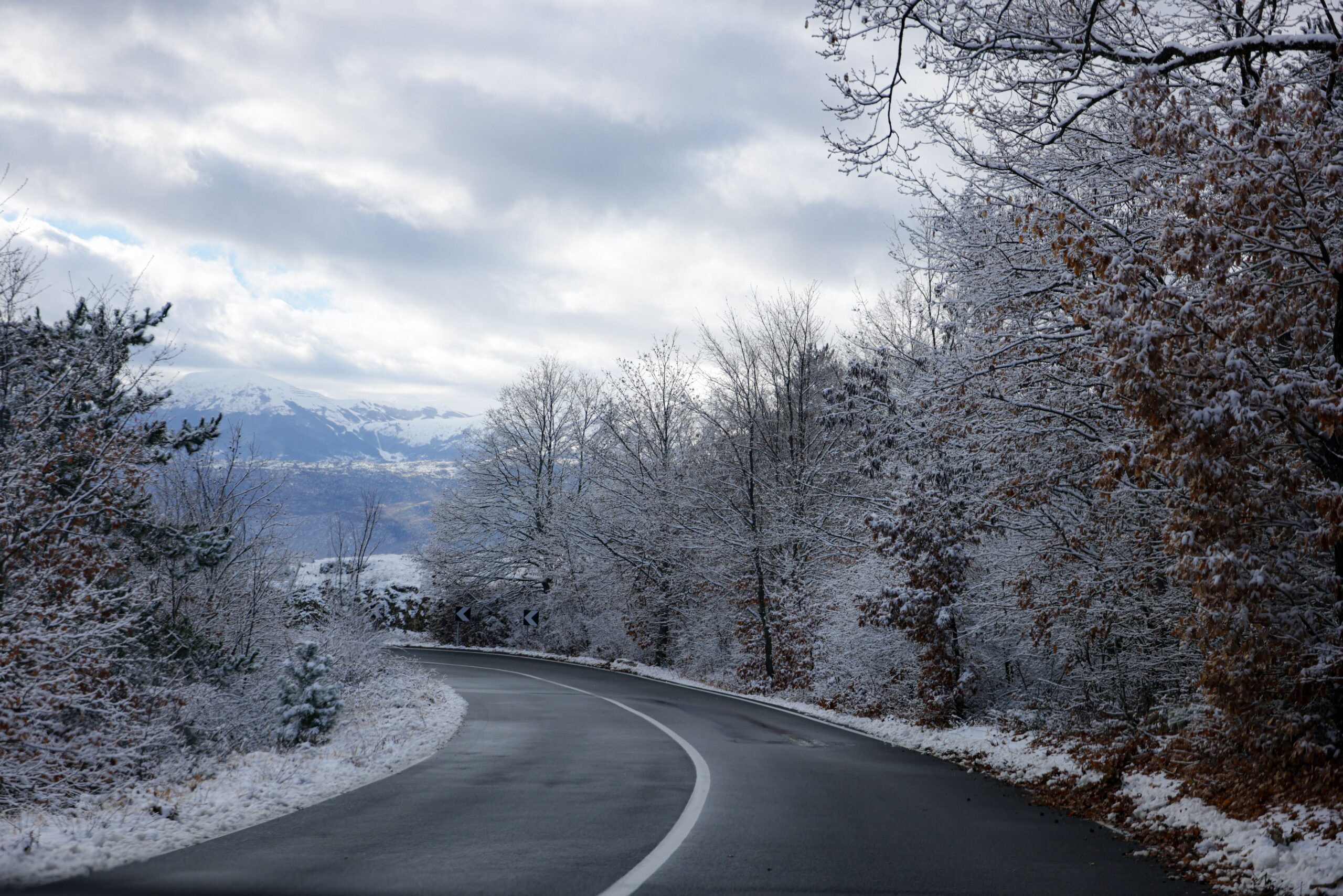
What Weather Can the UK Expect?
The UK located on the other side of the world from the Southern Pacific Ocean, so the UK will experience significantly less effects than other parts of the world. However, this doesn’t mean our weather won’t be affected, it will just be less extreme and less likely.
Some meteorologists predict that October, November and December will be warmer and wetter than normal, resulting in stormier windier conditions. This can already be seen by storms Austin and Boelo from the last few weeks of October.
In the new year, meteorologists predict conditions will change, as warmer Pacific waters warm atmospheric air temperatures. This may cause sudden stratospheric warming, disrupting the polar vortex and bringing colder, harsher but drier weather in January and February, with an increased chance of snow and ice.
The El Niño event should be drawing to a close around April time as the spring season begins.
These events could result in flooding, power cuts, damage from high winds and frozen roads.
It is important to remember these are just predictions and because we have never experienced an El Niño event of this size there is no need to panic. It is very unlikely the UK will experience extreme weather events, and we have plenty of time to prepare for the events predicted.
How Can You Prepare?
To prepare for flooding, power cuts, strong winds and icy roads, stay up to date with weather forecasts and warnings, which often include important safety advice.
Keep spare batteries and a first-aid kit for emergencies. You may not need them, but it is always best to be prepared. Clear your gutters and check your roof tiles to prevent damage during heavy rain. Prepare your car for icy roads and consider investing in winter tyres. Have your boiler checked before temperatures fall to ensure it is working properly.
Emily McHugh is a placement student from the University of Sheffield and currently carries out the role of aAssistant Estates Manager at Trustgreen. She has a passion for environmental topics and enjoys sharing her knowledge on topics relating to environmental issues and raising awareness on the actions we can take to help.

How the Super El Niño Event Will Affect the UK
Learn all about this year’s super El Niño event and how to prepare for its effects on the UK.

Commonwealth Environment & CSR Awards 2026
We were lucky enough to walk away with not just one, but TWO awards at the Commonwealth Environment and CSR awards in Glasgow.

Trustgreen Double Their Win at The Green World Awards 2026!
Trustgreen has been awarded not one, but two Green World Awards by the Green Organisation at the 2026 Green World Awards.

SuDS: A Sustainable Solution to Drainage
SuDS are an important feature on many of our sites, but what are they really for and how do they work? Kiera Hall discusses in our latest blog post.

Trustgreen are Now Members of the House Builders Federation (HBF)
Trustgreen are pleased to announce our ongoing collaboration as members of the HBF

Trustgreen Charity of the Year 2026
Trustgreen is excited to announce that we’ll be supporting Parkinson’s UK in 2026, who support every Parkinson’s journey, every step of the way.

Trustgreen Gains Green Glory
Adding to our third consecutive CSR Excellence Award Win, Trustgreen have been announced as CSR World Leaders.

The Big Garden Birdwatch: what it is & why it’s important and how to get involved
Dominic explores why The Big Garden Birdwatch is important and how you can get involved.
